 |
WORLD MAPS at Aquila Books
|
|
|
|
WORLD MAPS at Aquila Books
|
|
|
Books ~ Ephemera ~ Artwork ~ Manuscripts ~ Maps ~ Photographs ~ Charles Van Sandwyk ~ Catalogues |
|
Fram Museum Publications ~ Artifacts, Antiques, Collectables & Scientific Instruments ~ Aquila Publishing ~ L. M. Montgomery
About Aquila ~ Want Lists ~ Ordering ~ Selling to Aquila
|
|
Aquila books specializes in maps of Western North America and the Arctic. We also maintain a good inventory of world maps from the 16th century to the early 20th century. As we only have a very small sample of our stock online it is best to view our inventory at the shop.
If you wish to sell something in this category, looking for something specific you do not see or have any questions please contact us. When inquiring regarding a specific piece please provide us with the Aquila Books number listed below the item
|
|
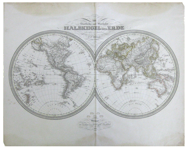
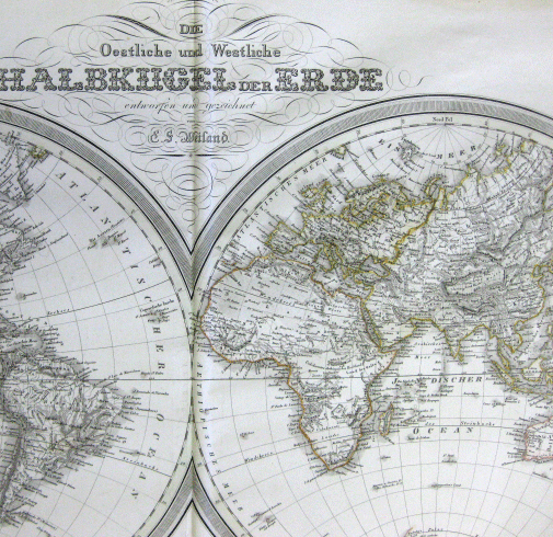
Above- full map, Below- detail closer up
Weimar Im Verlage Des Geograph Instituts. Die Oestliche Und Westliche Halbkugel Der Erde Entworfen Und Gezeichnet Von E. S. Weiland
[Original 1838 World Map].Weimar, 1838. Very good. 21" X 26.5" (53.34 X 67.31 cm). All continents except for America have been outlined in colour by hand (in oranges and yellows) with legend beneath. Subtle greenish tinge to the border surrounding each circle. Deep creasing down middle of map (vertically). Some light creasing, small closed tears and chipping to map, mainly near edges; as well as slight rippling across the page. Yellowish discolouration to bottom and top edges (visible a couple of inches into the page), however this not intrusive to the map or decoration.
World is shown split into two circles attaching at the center (With America and part of Australien on the left and Africa, Europa and Asien to the right). Delicate line decoration surrounding title and publication information. A beautiful antique map.
Aquila Books # 134800 - $675.00 |
|
|
|
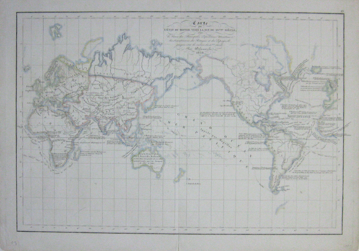
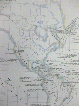
Delamarche, Pav. Carte de L'etat Du Monde Vers la Fin Du Xveme Siecle Avec le Trace Des Principales Expeditions Maritime Des Scandinaves Des Portugais et Des Espagnols, Jusque Vers le Milieu Du 16eme Siecle. [Original 1838 World Map]
Pav Delamarche, 1838. Very good. 13" X 18.5" (33 X 47 CM) original map. Finely detailed with hand coloured outlines. Light vertical crease down center (Short 1" tear coming up crease from bottom with a smaller tear at top of crease). Slight wear and soiling to edges; corners are slightly rounded with wear. A beautiful map with delicate details.
Map spans from Europe and Africa to the left across Asia, the Mer Pacifique/Grand Ocean (Pacific Ocean), North and South America to the tip Western tip of Africa and Europe repeated to the right. Only a small partial piece of land is visible past the Southern tips of South America, Australia and New Zealand. A simple square line border surrounds the map. Aquila Books # 134841 - $150.00 |
|
|
|
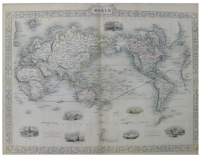
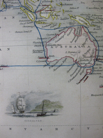
Rapkin, J. The World on Mercator's Projection.
London & New York: J & F Tallis, [circa 1830]. Near fine. 11 X 14" (28 X 35.5 cm). Vertical crease down center. Very slight darkening to edges- else in beautiful condition. Hand coloured outlines and ship's route in rich tones. Decorative blue and yellow painted border with title at top. Seven small illustrations depicting different famous destinations, all of which have been delicately hand coloured.
World map which starts on the left and ends on the right with the Westernmost tip of Africa. Bear Island and the bottom tip of Greenland make up the top border with the bottom ending in a couple subtle hints of the Antarctic. Deep pinkish-red has been used to denote British Colonies while a dark blue line highlights the Steam Route to these colonies. Map drawn and engraved by J. Rapkin. A very detailed map with beautiful little illustrations. Illustrations by H. Warren and engraved by J. B. Allen.
Aquila Books # 134850 - $275.00 |
|
|
This page updated June 27th 2013
[ HOME ] [MAP INDEX] [RETURN TO TOP OF PAGE] [CONTACT US]